
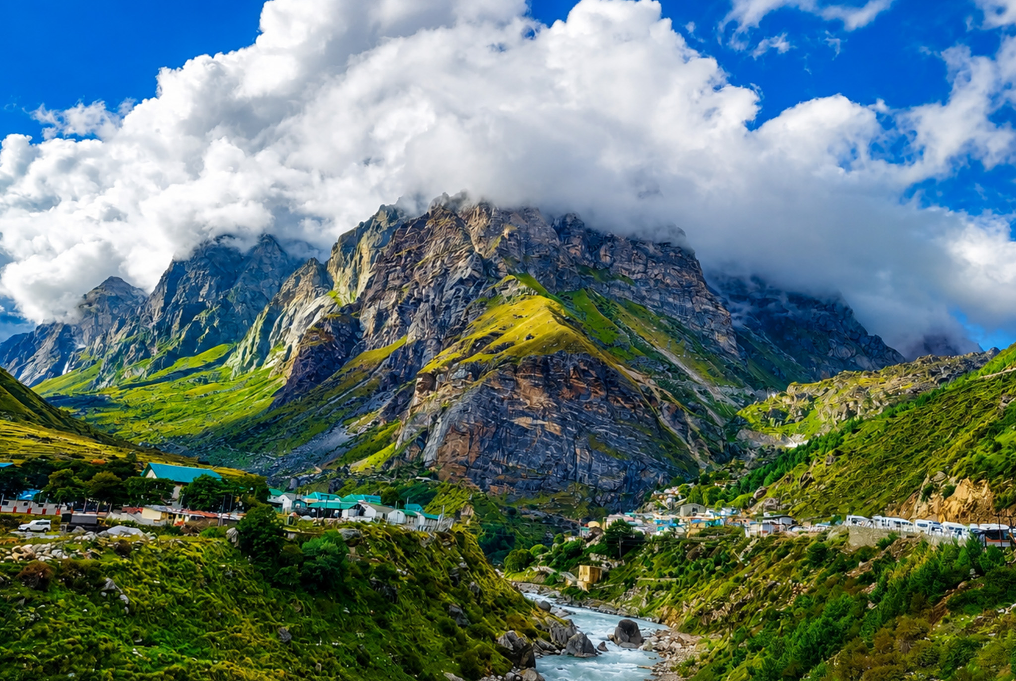
Badrinath sits high in the Chamoli district of Uttarakhand, tucked between the Nar and Narayan mountain ranges along the banks of the Alaknanda River. At an altitude of around 3,300 metres, it is one of the four sacred sites of the Char Dham circuit and one of the 108 Divya Desams dedicated to Lord Vishnu. For anyone planning a first visit, the town can feel deceptively simple. A single main temple, a hot spring, a river, a bazaar. The real experience, though, lies in understanding how to get there, when to go, and how to structure the journey without exhausting yourself before you reach the shrine.
This Badrinath travel guide walks you through the location, routes, best time to visit, key stops, and practical tips that most first timers wish they had known earlier.
Where Is Badrinath Located
Badrinath Dham is located in the Garhwal Himalayas of Uttarakhand, roughly 300 kilometres from Rishikesh and about 500 kilometres from Delhi. Administratively it falls under the Chamoli district, and geographically it lies close to the India Tibet border. The town sits in a narrow valley formed by the Alaknanda, with the twin peaks of Nar and Narayan standing on either side and Neelkanth Parvat rising sharply to the west.
The Badrinath temple opens roughly between late April or early May and closes around the third week of November, aligning with weather windows in the high Himalayas. Exact opening and closing dates are announced each year based on the traditional Panchang calendar.
How to Reach Badrinath
There are three practical ways to reach Badrinath Dham: by road, by air combined with road, and by helicopter for a portion of the route.
By road
Most travellers drive from Haridwar or Rishikesh. The usual route runs through Devprayag, Srinagar, Rudraprayag, Karnaprayag, Chamoli, and Joshimath before the final climb to Badrinath. The road is scenic but slow, and it is often restricted near Joshimath during heavy monsoon spells due to landslide risk.
By air
The nearest airport is Jolly Grant in Dehradun. From here, travellers usually take a taxi or a shared cab to Rishikesh or Haridwar and continue by road. There is no direct commercial flight to Badrinath.
By train
Rishikesh and Haridwar are the nearest major railway stations. Onward travel is by road.
By helicopter
Helicopter services operate from the Sahastradhara helipad in Dehradun to the Badrinath helipad during the yatra season. This option cuts several days off the journey and suits senior citizens, families with young children, and travellers with tight schedules. The Chardham Yatra by Helicopter from Dehradun package is a common pick for pilgrims who want to cover all four dhams in five to six days without long road stretches.
Best Time to Visit Badrinath
The best time to visit Badrinath is between May and June, and again from September to mid October.
- May and June: Pleasant days, cool nights, clear mountain views. This is peak season, so hotels and darshan queues are busier.
- July and August: Monsoon. The valley looks its most dramatic, but landslides and road restrictions are common. Avoid unless you have flexible dates.
- September to mid October: Post monsoon clarity, thinner crowds, and comfortable weather. Many regulars call this the sweet spot.
- Late October and November: Cold, with early snow possible. The temple closes for winter within this window.
The town shuts down for pilgrims through winter, as heavy snow makes access impractical and the presiding deity is moved to Joshimath for the season.
Key Places to See in and Around Badrinath
Badrinath Temple
The main shrine, painted in bright colours, sits on the right bank of the Alaknanda. The Singh Dwar entrance faces the river. Darshan timings are split into morning and evening sessions.
Tapt Kund
A natural hot water spring near the temple. Pilgrims traditionally bathe here before darshan.
Mana Village
Around three kilometres beyond Badrinath, Mana is often called the last Indian village on the route to Tibet. It has a small local market, Vyas Gufa, Ganesh Gufa, and the striking Bheem Pul.
Vasudhara Falls
A trek of roughly nine kilometres round trip from Mana. The waterfall drops from a great height, and local belief holds that its water only touches pure souls.
Neelkanth Peak
Best viewed at sunrise from the temple courtyard. The peak turns a soft golden colour that most photographs never fully capture.
Charan Paduka
A short but steep trek offering panoramic views of the valley and, on clear days, the temple complex below.
Suggested Itinerary Structure
A typical Badrinath trip works well as part of a wider circuit. Solo Badrinath visits from Delhi generally take four to five days including travel. Most pilgrims prefer to combine Badrinath with Kedarnath through a Do Dham route.
The Do Dham Yatra package covers both shrines with acclimatisation stops at Rudraprayag and Joshimath, which is especially important at high altitude.
For those planning a fuller Uttarakhand experience with pilgrimage and scenic stops, the Uttarakhand destination page lists options that combine Badrinath with Auli, Rishikesh, and Chopta.
If you are travelling from the capital and want a structured circuit covering all four dhams, the Chardham Yatra from Delhi package is a solid starting point.
Practical Tips for Badrinath Travel
- Carry warm layers even in summer. Nights are cold at 3,300 metres.
- Reach Joshimath a night before your Badrinath drive to help your body acclimatise.
- Keep a light medical kit with basic altitude and cold medicines. Consult your doctor before the trip.
- Carry a government photo ID and complete the Char Dham registration if required for the current year.
- Cash is useful. ATMs work but can be unreliable during peak days.
- The temple discourages leather items. Leave belts and wallets at your stay.
- Photography inside the sanctum is not allowed.
Food, Stay, and Local Culture
Food in Badrinath is largely vegetarian and sattvic. Local dhabas serve simple thalis, aloo puri, and rajma chawal. Mana village has small stalls where you can try local rotis. Accommodation ranges from dharamshalas and guesthouses to mid range hotels. During peak weeks, book well ahead as good rooms fill quickly.
Traveloi has planned Do Dham and Chardham journeys for a wide range of travellers, from first time pilgrims to senior citizen groups. A well built itinerary handles the small details, from acclimatisation nights to darshan slot planning, that make the difference between a rushed trip and a memorable one.
FAQs
1. Where is Badrinath located?
Badrinath is located in the Chamoli district of Uttarakhand, in the Garhwal Himalayas, at an altitude of around 3,300 metres on the banks of the Alaknanda River.
2. What is the best time to visit Badrinath?
The best time to visit Badrinath is May to June and September to mid October, when the weather is stable and darshan is comfortable.
3. How do I reach Badrinath from Delhi?
From Delhi, most travellers drive or take a train to Haridwar or Rishikesh, then continue by road through Rudraprayag and Joshimath. Helicopter routes from Dehradun are also available during the yatra season.
4. Is Badrinath open in winter?
No. The Badrinath temple closes for winter around November and reopens in late April or early May. The deity is moved to Joshimath during the closed months.
5. How many days are enough for a Badrinath trip?
A focused Badrinath trip from Delhi usually takes four to five days. A Do Dham with Kedarnath needs six to eight days, and a full Char Dham circuit needs ten to twelve days by road.
6. Is Badrinath suitable for senior citizens?
Yes, with the right planning. Helicopter packages and gradual acclimatisation itineraries make it manageable. A doctor clearance is recommended for anyone with heart or breathing conditions.
7. What should I pack for Badrinath?
Warm layers, waterproof jacket, sturdy walking shoes, personal medicines, sunscreen, a basic first aid kit, and printed copies of ID and booking confirmations.